01The short answer
Yes. I live here, my friends live here, and I walk the beach at sunset without thinking about any of this. Baja California Sur is widely considered one of Mexico's safest states, and the things most likely to hurt you in the corridor are the ocean and the highway, in that order.
That's the 50-word version, and I stand behind it. But "is it safe" is the wrong question. The right question is "what's actually risky here, and how do people who live here handle it?" That one has a useful answer, so let's do that instead.
02What "safe" actually means here
Some context, because your mother's headline was probably about a different Mexico. Mexico is 32 states, and painting them with one brush makes about as much sense as judging Montana by Baltimore's crime blotter.
Baja California Sur is a peninsula-tip state with an economy built on tourism, fishing, and agriculture. As of this writing, the U.S. State Department has BCS at Level 2: exercise increased caution. For calibration, that's the same advisory tier as France, the UK, and Spain. Check the current advisory yourself before you travel; these things get updated, and you shouldn't take a website's word for it (including mine).
My personal calibration, for what it's worth: I've lived in San Diego, and I've lived here. My day-to-day feeling of security in Cerritos is as good or better. Doors get locked. Nobody's paranoid. The stuff I actively think about is waves and cows, which brings us to the real list.
03The ocean is the thing that will actually get you
If I could make every visitor read one section, it's this one. The Pacific on this coast is gorgeous, powerful, and indifferent to your vacation plans.
Most beaches in the corridor are for walking. Playa La Cachora and the beaches right at Todos Santos have serious rip currents and a steep shore break; locals stroll them, photograph them, and stay out of them. The swimming happens at Cerritos (about 40 minutes south, 12 mi / 19 km), and even Cerritos has rips when the swell picks up.
Swim at Cerritos, and know exactly what that does and does not buy you. There is a lifeguard tower near the point by Barracudas, but it is not always staffed and no hours are posted (checked August 2026). Most of the actual watching here is done by local surfers and Good Samaritans. Ask a surfer about conditions before paddling out anywhere; they'll tell you straight. If you get caught in a rip, swim parallel to the beach until you're out of it, then in. And never turn your back on the shore break. People get hurt in waist-deep water here every season.
I surf and play beach volleyball here year-round, and the ocean is a huge part of why any of us came. Respect it and it gives you everything. Treat it like a hotel pool and it will humble you fast.
What nobody hands you here: there is no flag system
Americans arrive with a mental model built on lifeguard towers and coloured flags. That model does not transfer. There is no Norma Oficial Mexicana governing beach warning flags in Mexico, so flags are set municipality by municipality, and Todos Santos and El Pescadero are delegations of the La Paz municipality, not Los Cabos. The daily flag reports, the trained guardavidas, the towers with video surveillance you may have read about are Los Cabos infrastructure. La Paz's own reinforced beach operation, announced 30 July 2026 with 230 personnel and naming Todos Santos explicitly, lists no lifeguards and no flags at all.
If you do see a flag somewhere on this coast, know that two colours mean the opposite of what an American reader expects: purple signals harmful marine life, not surf, and black is a closure, a step above red rather than below it.
The honest number
At least five people drowned at Todos Santos beaches in 2026 (El Sudcaliforniano, 30 July 2026). Punta Lobos was certified “Playa Platino” by ZOFEMAT La Paz on 31 July 2026, thirteen days after a drowning there. Both facts are true at once, and holding them together is the whole point: a certification is about water quality and beach management, not about whether anyone will pull you out.
If you are caught in a rip
CENAPRED's guidance is worth following verbatim: stay calm, do not fight the current, swim parallel to the shore until you are out of the pull, then angle in, and signal for help. Its final step is to attract the lifeguard's attention. On this coast that assumption does not hold, and that gap is the reason this section exists. In practice the people who pull swimmers out here are surfers in the water and whoever is standing on the sand.
Numbers worth having in your phone before you get in
911 nationwide. Bomberos Voluntarios de Pescadero +52 612-183-0911. Protección Civil La Paz (612) 123 7900. Save them now rather than looking them up one-handed on a beach with no bars. Checked August 2026.
04Driving: the cow problem is real
Highway 19 is paved, scenic, and easy by daylight. The rule every local follows: don't drive it at night. Ranching here is open-range, and a black cow standing on a dark highway is functionally invisible at 60 mph / 100 kph. That's the single most common serious accident in the area, and it's fully avoidable by scheduling your drives.
The other quirks are minor once you know them. Topes (speed bumps) appear with minimal warning; the ones entering Pescadero have launched plenty of rental cars. Dirt roads west of the highway wash out after storms. And your U.S. auto insurance is worth nothing in Mexico, so buy a Mexican policy (Baja Bound and Lewis & Lewis are the usual picks; both are cheap).
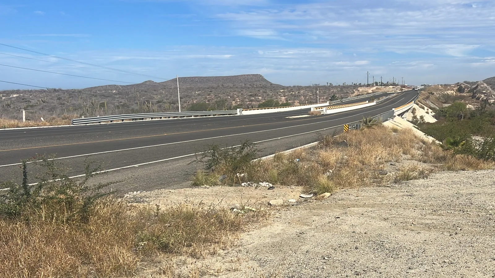
Here is the part that only makes sense once you live here. The U.S. State Department advisory for Mexico, updated 29 May 2026, tells travellers to use toll roads. On MEX-19 that instruction is structurally impossible: the highway is toll-free its entire length. There is no toll road to take. It is a good, sane rule written for a different part of the country, and it is the cleanest example I know of why living here is different from reading the reports from the States. Canada's advisory, updated 29 July 2026, is more useful for this coast: it names stray livestock as a specific highway hazard, which is exactly the thing that will actually hurt you.
There is no road-status source. Plan around that.
Mexico has no 511 equivalent, and there is no official real-time status feed for MEX-19. The federal Guardia Nacional Carreteras app exists but has not been updated since 2023 and sits around two stars; do not build a plan on it. Two phone numbers circulate and both get misapplied: 074 is CAPUFE's toll-network line and does not cover this highway, because MEX-19 collects no tolls. 078 is Ángeles Verdes, the roadside assistance service, and it runs 08:00 to 18:00, which means it is not there for exactly the night driving you were already told to avoid.
What residents actually use, in the order we reach for it: Waze or Google Maps first, understanding that both are crowd-sourced and only as current as the last driver who reported something; @GobBCS on X for state weather suspensions and closures; noticias.lapaz.gob.mx, which is the correct jurisdiction for this stretch and runs its Operativo Huracanes from 15 May to 30 November; and smn.conagua.gob.mx when you want the weather causing it rather than the traffic result. Checked August 2026.
05Petty theft: the actual crime you might encounter
Here's the honest crime report for the corridor: the thing that happens is opportunistic petty theft, and the classic version is a smash-and-grab at a surf-break parking lot. A backpack visible on a car seat at San Pedrito is an invitation. Locals leave cars empty and unlocked at the breaks, or bring nothing worth taking.
House break-ins happen occasionally, mostly at obviously empty vacation homes in isolated spots. If you buy here, you'll do what everyone does: a caretaker, a neighbor who watches things, maybe cameras. Standard small-town stuff.
What you won't find is the mugging-and-pickpocket economy of a big city. There's no neighborhood in Todos Santos or Pescadero I'd tell you to avoid walking through. I can't say that about most American cities I've worked in.
06Okay, the cartel question
You were going to ask, so let's do it properly.
Organized crime in Mexico is real, and I'm not going to insult you by pretending otherwise. It's also concentrated: specific regions, specific routes, specific business lines. The corridor is a farming and tourism strip on the Pacific side of the peninsula's tip. It isn't contested territory, and violence connected to that world overwhelmingly happens between people inside it.
The practical version: don't buy drugs. That single sentence is most of the safety briefing.
The tourists and expats who find trouble in Mexico are, with rare exceptions, people who went looking for it. Live your life here (surf, dinners, work, volleyball) and that world has no reason to know you exist. That's been my experience, and the experience of everyone I know here, over years of actually living it rather than reading about it.
07Women and solo travelers
I asked several friends here to gut-check this section, because I'm a 52-year-old guy and my experience isn't the whole picture.
The consistent answer: women in the corridor describe feeling safer than in comparable U.S. beach towns, and there's a large community of women who arrived solo and built lives here. The town is small, faces become familiar fast, and the social fabric is tight enough that people notice things.
The standard practices still apply, same as anywhere: share your location when you're meeting someone new, use a driver you trust for late nights instead of walking dark stretches, and keep your drink in your hand at bars. Boring advice because it's universal advice.
08Storms, sun & scorpions
Hurricane season runs roughly June through November, and September is the month locals watch. Modern forecasting gives you days of warning, and the corridor's routine is well rehearsed: water, fuel, cash, charge everything, stay off the roads while the arroyos run. If you're here in September, know where your information comes from (the local WhatsApp groups are faster than the news).
The sun is the injury you'll actually take home. We're on the Tropic of Cancer; the UV index doesn't care that the breeze feels nice.
Scorpions exist, mostly in wood piles and shoes left outside. Shake out your boots, keep a flashlight by the bed, and know that stings are painful but very rarely serious for healthy adults. In several years here I've been stung exactly zero times.
09The local playbook
Everything above, compressed into the 8 rules people here follow on autopilot:
1. Swim at Cerritos, near the tower. Walk the other beaches.
2. Ask a surfer before you paddle out. They will tell you the truth.
3. No night driving on Highway 19. Cows.
4. Mexican auto insurance before you cross the border.
5. Nothing visible in a parked car at the beach. Ever.
6. Don't buy drugs.
7. September: watch the forecast, join the WhatsApp groups.
8. Shake out your shoes.
That's it. That's the list. Notice what's on it (physics and common sense) and what isn't (fear).
10Quick answers
Is Todos Santos safe for tourists? Yes, by any practical measure. Normal travel awareness applies, same as a trip to Portugal.
Is the Cabo-to-Todos Santos drive safe? Yes: 47 mi / 76 km of paved highway. Do it in daylight.
Can I drink the tap water? No, and nobody here does. Every house runs garrafones or filtration. Restaurants use purified water and ice.
Do I need to speak Spanish to stay safe? No, but learn some anyway. It changes your experience of the place, and in a pinch (a medical thing, a car thing) it helps a lot.
Where's the nearest hospital? Clinics in Todos Santos handle everyday care; the serious hospitals are in Cabo San Lucas (about 47 mi / 76 km) and La Paz (about 50 mi / 80 km). If you live here, get evacuation-inclusive insurance; most of us carry it and never think about it again.
Curtis brokers real estate through Selling Sur in the Todos Santos–Pescadero–Cerritos corridor, and lives in Pescadero, at San Pedrito Beach. He doesn't sell a fantasy; he sells information so you can make a smart call, including the call that Baja isn't right for you.